Alaska Part I: June 17-25, 2005
Journals
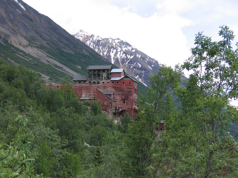
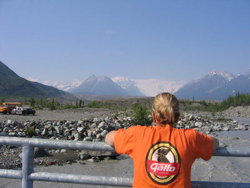
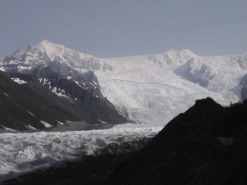
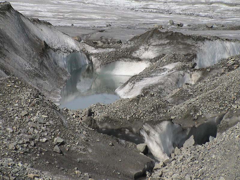
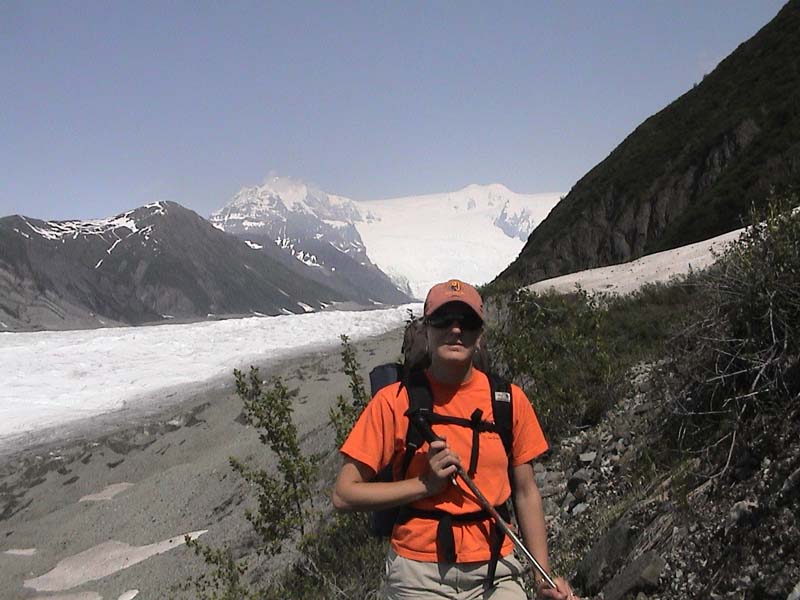
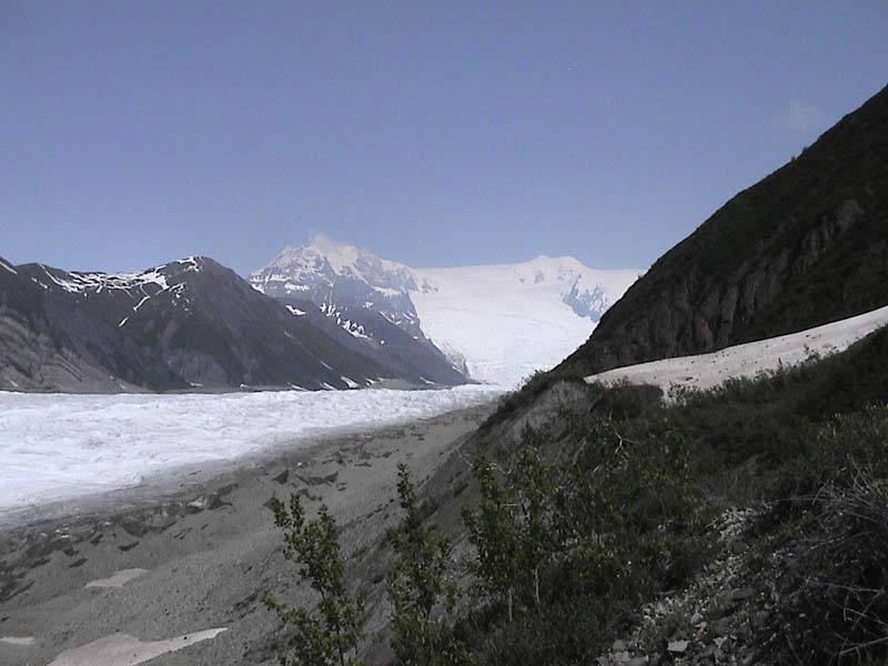
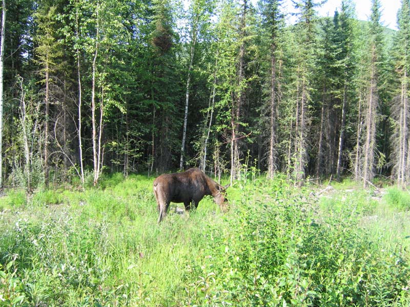
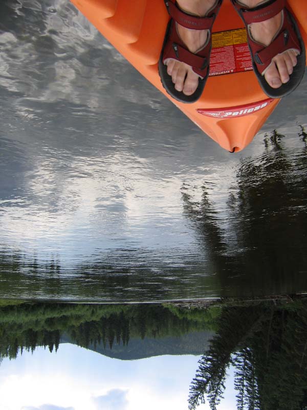
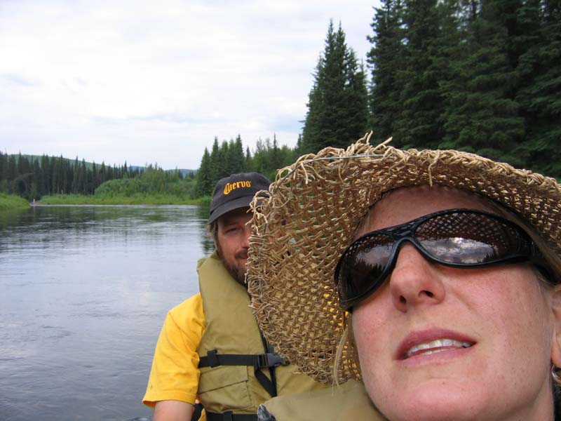
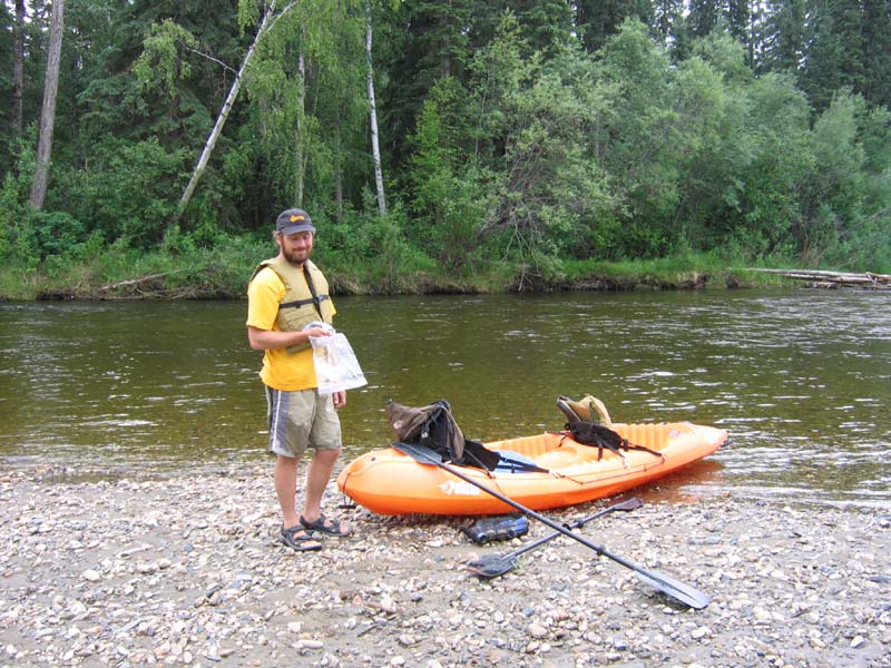
On Friday we drove from Dawson City, Yukon over the "Top of the World Highway" into Alaska. From there, we continued down the Taylor Highway to rejoin the Alaska Highway just a few miles east of Tok. The road was very scenic, although a little rough. The border entrance station to Alaska is supposedly the most northern land entry station to enter the United States-two people work on the US side. We arrived in Tok early afternoon because we had a couple of things to do like wash the dirt off the camper and truck-lots of it. In addition, we knew that the doctors were considering inducing labor for Lisa's sister's baby so we wanted to be near a phone. Turns out we made the right choice as they did induce labor, and Kate had a baby girl at about 9pm EDT!! Born at just under 8lbs, named Abbey Wren Murray. We'll post a photo as soon as we get one. After doing some research on our options for a couple days, we finally decided in Tok not to drive the entire Dalton Highway-too long and rough for this trip, but we'll do it on another trip some day. Instead, we decided to head south to the Wrangell-St. Elias National Park and Preserve. This is an area that I had seen on the map a couple of times during my early planning phases, but we were planning to pass it by after our return from Cordova to Valdez (last part of our stay in Alaska) because we'll need to be getting back on the road towards home by that point. So, we did cover a little bit of road that we'll be back on again at the end of our trip, but it was well worth the time spent. Additionally, the only road into the park is pretty rough-takes nearly 3 hours to cover 60 miles so it would not have been a good choice for a quick side trip. This is not your average National Park by any means-although it is the largest park in the National Park System (13.2 million acres-6 times the size of Yellowstone National Park!!), it has some of the most limited road access I've seen in any park. A good reason for lack of access is the extreme nature of the wilderness-peaks in excess of 16,000 feet, largest glaciated area on this continent, vast canyons, etc. Aside from the road, the only way to visit this park is via backcountry travel, mostly assisted by small airplanes and helicopters. The road in goes for 60 miles from the town of Chitina to the town of McCarthy. From McCarthy, it's another 5 miles by foot, bike, or shuttle van to the mining town of Kennicott. This area was originally accessed via railroad from Cordova for copper ore mining-apparently there was a lot of copper here because getting a railroad in was a major endeavor. On Saturday, we drove from Tok down to Chitina where we found a small RV park that was willing to let us leave the camper parked for $5/day. We camped there on Saturday night, and prepared for backpacking. On Sunday, we drove across the Copper River and the 60 miles into McCarthy. We found a place to park the truck there, and then biked into Kennicott to get some additional information on our hiking/backpacking options. The National Park rangers were very helpful, and we planned a trip to hike in about 5 miles to a lake right above the Root Glacier ("DOGS? of course it's OK to take your dogs along!" National Park-dogs? First time I ever heard of a National Park allowing dogs on a trail if that gives you any idea of how different this place is.) We slept in the truck on Sunday night after dinner and drinks at the local bar in McCarthy. Very friendly mountain town folks-one of whom knows Bob Toohill! Guy's name was Garrett, and he mentioned having lived in Crested Butte, Colorado a number of years back-I asked him if he knew a Bob Toohill, and he said the name was familiar. I asked him about a couple of Bob's friends that I've met from those days, and this guy used to live with Jazz (of Kent and Jazz). He's also known Mortimer from Silverton, and knew Tony from Salida through the boot shop. Turns out he remembers going on a hut trip in the San Juans with Bob, Jazz and some other guys-I'll have to check this out with Bob. Monday morning, we hitched up our packs and took the shuttle van into Kennicott to start our backpack trip. Going was a little slower than we had planned due to poor trail conditions-very few trails in this park, and all minimally maintained. We hit the moraine (area of ice, rock, scree adjacent to the glacial ice) and that slowed us down even more, so we didn't get all the way to the lake-close enough though, and right next to the glacier. We spent the might camped there-cold that night! Tuesday morning, we broke camp and did some exploration of the glacier before heading back. I've never been this close to a glacier, and it was cool to watch all of the activity occurring: mini rocks slides, melting ice, etc. Quite a lot of activity for such a slow moving mass-amazing to think that it takes millions of years for glaciers to carve out these valleys and peaks, but that there is so much activity on an ongoing basis. We were next to the Root Glacier-very big to look at when you are standing next to it, but on the map of this park, it's just a small finger off of the main glaciers. We did get far enough up it to see some of the larger icefalls ahead, and it was simply stunning to see. Although it would be well worth the money for a plane ride to sightsee or overnight in this park, we've got other plans ahead that are going to take some serious money, so we need to wait. This park is on the list of places to return to for sure, and I would recommend it to anyone wanting to beat the crowds-I have no doubt that we've seen some of the best things we'll see on this trip, with hardly anyone else around to crowd us out. We hiked all the way back to our truck on Tuesday-decided not to take the shuttle bus. Although it was a long hike, we decided to drive back out the dirt road to our camper so we could clean up that night (luckily, the ice held and the beers were nice and cold for the ride back!). Spent Tuesday night in the same RV park from Saturday night. Wednesday morning, we got up and drove north about 275 miles to Fairbanks. We spent the night near town in an RV Park so we could get our laundry and food shopping done. On Thursday we did a couple more errands in the morning before driving a short distance over to a campground on the road to Chena Hot Springs. Parked the camper there at a nice Alaska State Park, and then headed to the hot springs. Nice outdoor rock pool there, but no good exercise swimming for Lisa. The Chena river flows from the hot springs about 60 miles northeast of Fairbanks near the road and all the way back into Fairbanks and beyond. Because the river is near the road, and it's a clear flowing river, it is popular for canoeing and rafting. Our campground is right on the river, so we decided to plan a float trip for Friday. We did about 11 miles of the river starting above our campground, and ending right at camp. We used the bikes again for shuttle assistance, so we were able to complete this trip on our own. The river was beautiful and pretty easy (class 2), and we spent about 5 hours floating down-moose are abundant here, but we've seen no bears in Alaska so far (just those two in Canada). Today is Saturday, and we've spent the day around camp relaxing and enjoying this great area-writing this log, a little bike ride, and some calls back home. We'll probably spend the next couple nights here before heading down to Denali National Park where we have camping reservations for three nights. Hope everyone is doing well-talked to Bob in Colorado today and it sounds like things are good there!
Click any of the above photos to enlarge the image!